
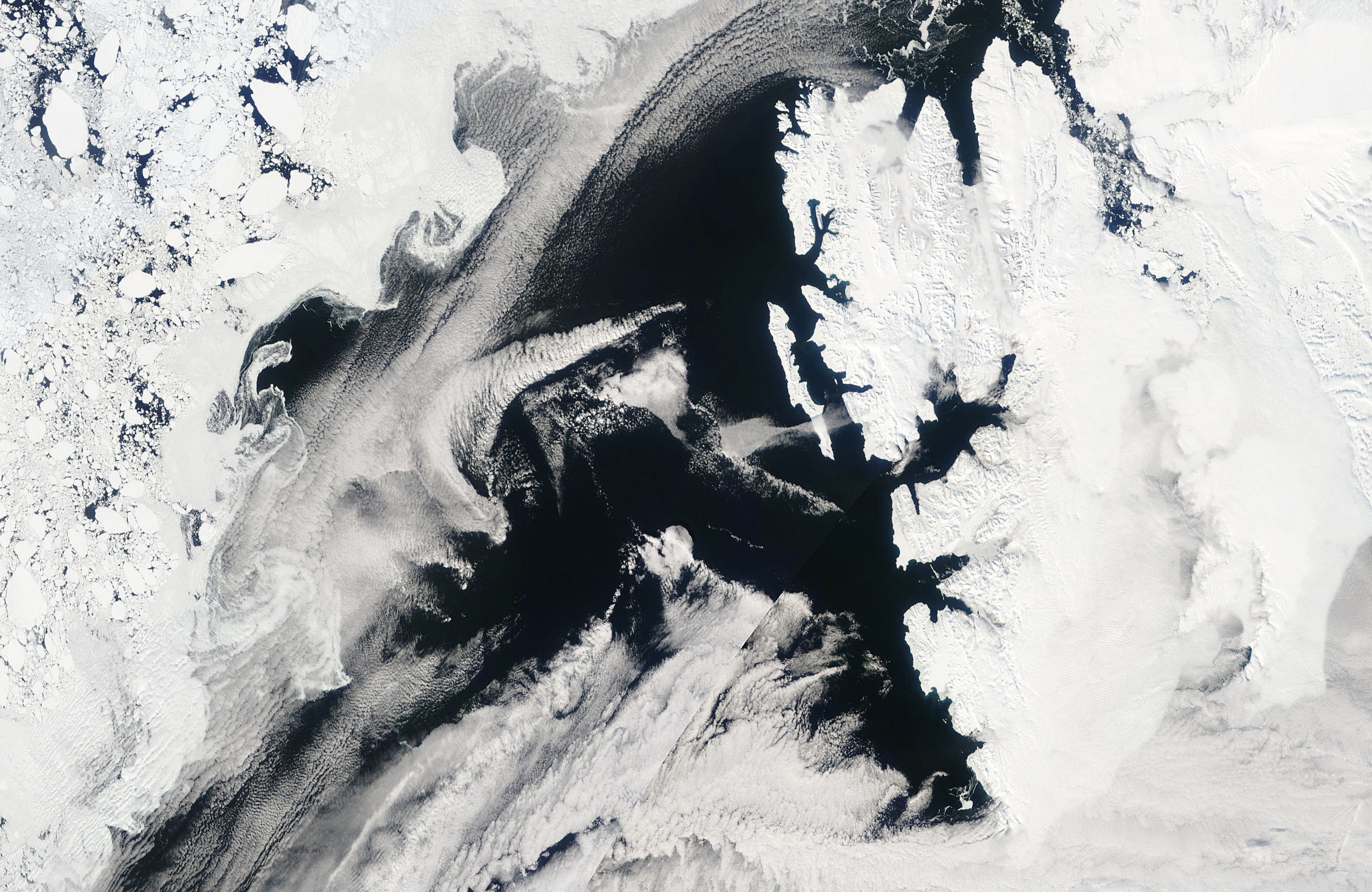
MODIS image showing the wake downstream of Svalbard on May 23 2007 (source: EOSDIS NASA)
In my last snack I wrote about how islands can act like rocks in a river and create beautiful wake patterns that are caught in the lenses of satellites passing overhead. There are some prerequisites: a stable lower atmosphere, a wind flow and of course an island to get in the way. A river surface makes a very nice analogy to an atmospheric inversion, the river flow is the wind and the rock on the river bed is the island. As we saw, the trade wind inversion in the Tropics is one such river surface, and islands like Hawaii and Madeira are the rocks. Inversions are also very prevalent in polar and arctic regions, where the lower layers of the atmosphere cool due to the freezing surface below. These conditions are common because the sea is covered by ice for much of the year.
When this cold air blows out across the sea powerful convection can result. However, due to the inversion the clouds do not reach huge heights. Instead we get cloud streets; long lines of rolling clouds perpendicular to the wind flow. These are both beautiful to observe but also offer visual trajectories, showing us exactly how the flow is responding to obstacles.
On the edge of the Arctic Ocean, strong easterly winds caused by passing cyclones force the cold air to flow straight towards the island of Svalbard. Myself and Erik Kolstad investigated the flow around Svalbard and compiled a climatology of the jets wrapping around the southern cape.
We can see from the cloud streets in the MODIS image above that the air is bent around the northern tip of the island. This indicates flow splitting upstream. There is also some indication of vorticity in the flow in the northern part of the wake. The visual effect of this wake extends about 500 km. Myself and Erik found that these events occur on average 8 % of time, but they are most common in the months January-April.

Vortices forming downstream of Jan Mayen on June 28 2003 (left) and February 13 2004 (right) (source: EOSDIS NASA)
There are many other islands in the Arctic that cause beautiful patterns to form. When the cloud conditions are favorable, dramatic satellite images can result. Jan Mayen is famous for its effect on the arctic atmospheric river. The image on the left (June 28 2003) shows the eerie vortices almost like the island is being dragged slowly through some thick moorland fog. The von Karman vortices that we see on the right (February 13 2004) can often still be seen over 500 km downstream of Jan Mayen. That’s a big effect for such a small island.

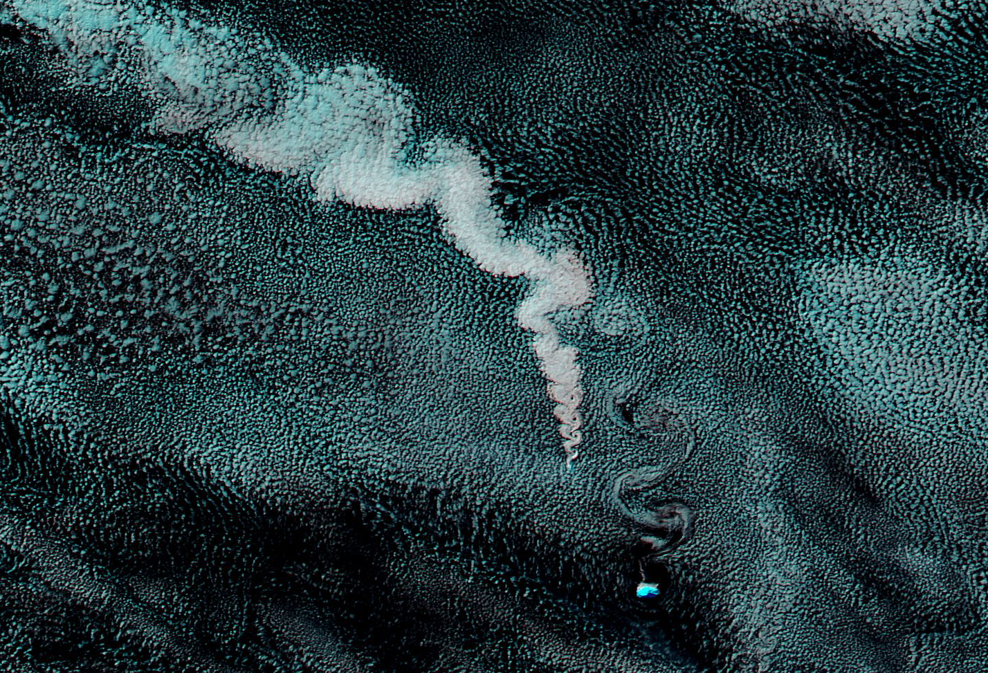
Gravity waves and vortices downstream of the Aleutian Islands on June 18 2006(left) and March 14 2010 (right) (source: EOSDIS NASA)
The Aleutien islands are a long band of volcanic islands stretching westward off the southern coast of Alaska. During cold air outbreaks, cold stable air rushes southward off the winter sea-ice sheet. The Aleutian Islands sit right in the way of this flow. The different shapes and sizes of the islands mean that we can observe many different flow regimes in a single event. The pictures here show gravity waves caused by the smaller Aleutian islands in the west and prominent vortices caused by the larger islands in the east.
Volcanic Ash illustrating the vortices downstream of Zavodovski Island April 28 2012 (source: EOSDIS NASA)
Its not only Hawaii where volcanic ash can highlight the prominant vortices occurring downstream of islands. Zavodovski Island is only about 5 km across and is one of the South Sandwich Islands situated in the deep south of the Atlantic Ocean. In April 2012, the ash and steam from the volcano on the small island got caught in the wind flow around the island. This accentuated the strong von Karman vortices that we can see in the MODIS image.
We are very lucky to be living in a time where we can simply download incredible satellite imagery free from the internet. Amazing things can happen when you stick an island in front of different types of flow. As we have seen it often results in patterns that we can also see in the streams and rivers we have on land. I always think its amazing that we can see analogies of things that happens in the large scale atmosphere in our own back gardens and sometimes even our own coffee cups (use soy milk in your coffee next time; then sit for a minute and watch the convective cells develop).
The phenomena are based on exactly the same physical principles (but usually differing assumptions), but the size can be hugely different. Here we have seen that phenomena that can only be seen from space have nice analogies in the streams we see around us.
 0
0
 0
0 0
0 0
0 0
0 0
0Mathew Stiller-Reeve
Latest posts by Mathew Stiller-Reeve (see all)
- SciSnack: The Next Generation - December 13, 2018
- Give us the foundation to build our transferrable skills! - June 25, 2018
- The art of exchanging weather stories - October 4, 2017